How to Reach Adi Kailash & Om Parvat: Route Guide from Delhi, Kathgodam & Pithoragarh (2026)
🗺️ Delhi to Adi Kailash Complete Route At-a-Glance
Total Distance: ~680 km| Route Leg | Distance (km) | Elevation (m / ft) | Mode of Transport | Travel Time |
|---|---|---|---|---|
| Delhi to Kathgodam | 280 km | 554 m / 1,817 ft | Overnight Train (Ranikhet / Shatabdi) | 6 – 8 Hours |
| Kathgodam to Pithoragarh | 180 km | 1,627 m / 5,338 ft | Mountain Taxi via Almora / Ghat | 5 – 6 Hours |
| Pithoragarh to Dharchula | 95 km | 915 m / 3,002 ft | Highway along Kali River (NH9) | 3 – 4 Hours |
| Dharchula to Gunji (Base Camp) | 75 km | 3,200 m / 10,500 ft | 4x4 Mahindra Bolero via Chialekh | 4 – 5 Hours |
| Gunji to Jyolingkong (Adi Kailash) | 32 km | 4,570 m / 14,993 ft | 4x4 Bolero + 1.5 km gentle walk | 1.5 – 2 Hours |
| Gunji to Nabidhang (Om Parvat) | 22 km | 4,246 m / 13,930 ft | 4x4 Bolero to Viewpoint | 1 Hour |
Do not attempt to drive private city sedans or non-4x4 vehicles beyond Tawaghat. The high-altitude stretch past Malpa and Chialekh Pass requires 200mm+ ground clearance, four-wheel drive low-range gearing, and drivers experienced with single-lane mountain cut-outs. All Rudraansh Yatra vehicles are local 4x4 Boleros operated by native Kumaoni mountain drivers.
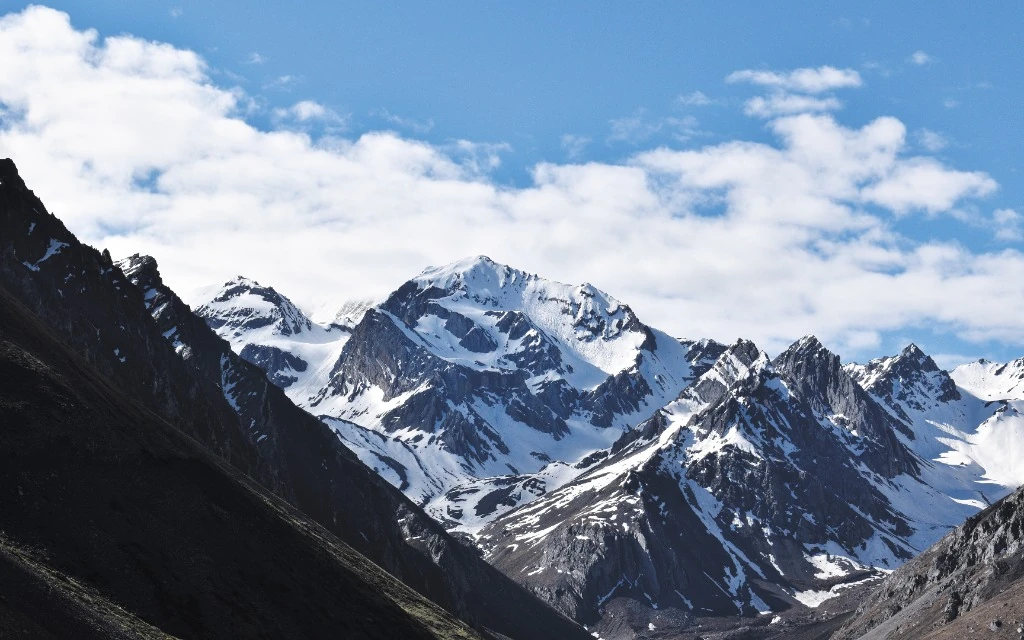
Reaching Adi Kailash and Om Parvat in the remote borderlands of Pithoragarh district, Uttarakhand, is one of India's most scenic mountain journeys. The route winds through the lush lower Kumaon hills, ancient deodar pine forests of Almora, roaring gorge rivers of Kali and Dhauliganga, and ascends into the breathtaking high-altitude Himalayan valley of Vyas.
Here is the complete step-by-step travel and route guide for travelers starting from **Delhi**, **Kathgodam/Haldwani**, or **Pithoragarh**.
---
### Route Overview & Distance Map
Delhi -> Kathgodam / Haldwani (280 km) -> Almora / Pithoragarh (190 km) -> Dharchula (95 km) -> Gunji Base Camp (72 km via 4x4) -> Jyolingkong (Adi Kailash - 32 km) & Nabidhang (Om Parvat - 18 km)
**Total Road Distance from Delhi:** Approx. 650 km
**Total Road Distance from Kathgodam:** Approx. 370 km
**Total Road Distance from Pithoragarh:** Approx. 180 km
**Vehicle Type Mandate beyond Dharchula:** 4x4 Mahindra Bolero / Tata Xenon (Private Hatchbacks & Sedans strictly cannot ply).
---
### 1. Reaching the Starting Hubs
#### Option A: By Train (Most Popular)
**Nearest Major Railway Station:** **Kathgodam (KGM)**, located 370 km from Dharchula.
**Top Trains from Delhi:**
*Kathgodam Shatabdi Express (Train 12040)* — Departs New Delhi at 06:20 AM, arrives Kathgodam at 11:40 AM.
*Ranikhet Express (Train 15013)* — Overnight train departing Old Delhi at 10:05 PM, arriving Kathgodam at 05:05 AM.
**From Kathgodam:** Board your pre-booked Rudraansh Yatra private 4x4 vehicle to drive directly to Pithoragarh or Dharchula.
#### Option B: By Air
**Nearest Operational Airport:** **Pantnagar Airport (PGH)**, approx. 34 km from Kathgodam and 240 km from Pithoragarh. Direct flights operate from Delhi (IndiGo / Alliance Air).
**Naini Saini Airport (Pithoragarh):** Regional flights connect Dehradun and Pantnagar directly to Pithoragarh under the UDAN scheme.
#### Option C: By Road from Delhi
**Drive Route:** Delhi -> Ghaziabad -> Moradabad bypass -> Rampur -> Bilaspur -> Rudrapur -> Haldwani -> Kathgodam -> Almora / Bhowali -> Pithoragarh.
**Drive Time to Kathgodam:** 6 to 7 hours over smooth national highway NH-9.
---
### 2. The Mountain Leg: Kathgodam to Dharchula via Pithoragarh
#### Day 1: Kathgodam -> Almora -> Jageshwar Dham -> Pithoragarh (190 km / 7–8 hrs)
Enjoy panoramic mountain views of the lower Himalayas.
Stop for darshan at **Kainchi Dham** (Neem Karoli Baba Ashram), **Chitai Golu Devta Temple**, and the 124 ancient Shiva shrines of **Jageshwar Dham**.
Night halt in Pithoragarh town (altitude: 1,627m) to begin initial acclimatization.
#### Day 2: Pithoragarh -> Ogla -> Jauljibi -> Dharchula (95 km / 3.5 hrs)
Drive along the tranquil Gori and Kali rivers that form the international border between India and Nepal.
Arrive in **Dharchula** (altitude: 915m) — the administrative gateway to the Vyas and Darma Valleys.
Complete physical document verification at the SDM office and ITBP headquarters.
---
### 3. The High-Altitude Border Leg: Dharchula to Gunji, Adi Kailash & Om Parvat
#### Day 3: Dharchula -> Tawaghat -> Malpa -> Chialekh Pass -> Garbyang -> Gunji (72 km / 4–5 hrs by 4x4 Bolero)
Cross the confluence of Kali and Dhauliganga rivers at Tawaghat.
Ascend the steep, dramatic mountain curves of **Chialekh Pass (3,800m)**, where you get your first view of alpine meadows and the majestic Api-Nampa Himalayan range in Nepal.
Pass the historic sinking village of **Garbyang** and arrive in **Gunji** (3,200m), your main high-altitude homestay hub.
#### Day 4: Gunji -> Nabi -> Kuti -> Jyolingkong -> Adi Kailash & Parvati Sarovar (32 km / 2.5 hrs)
Drive through the picturesque villages of Nabi, Rongkong, and Kuti (named after Kunti of Mahabharata).
Arrive at **Jyolingkong (4,570m)** for direct, unobstructed darshan of the sacred **Adi Kailash** peak, holy Parvati Sarovar, and Gauri Kund.
#### Day 5: Gunji -> Kalapani (Kali Mata Temple) -> Nabidhang -> Om Parvat Darshan (18 km / 1.5 hrs)
Visit the sacred **Kaali Mata Temple at Kalapani** (origin of the holy Kali River and Vyas Gufa).
Reach **Nabidhang (4,246m)** for the mesmerizing morning darshan of the natural snow OM on **Om Parvat**.
---
### Summary Route Tips for Travelers
1. **Do not drive private small cars beyond Dharchula:** The roads beyond Tawaghat require high ground clearance 4x4 vehicles with heavy-duty suspension and experienced local mountain drivers.
2. **Pre-arrange permits with a Pithoragarh operator:** Permit processing in Dharchula can take 24–48 hours if attempting independently. Rudraansh Yatra pre-processes everything so you don't waste precious vacation days waiting in lines.
---
*Ready to embark on this journey of a lifetime? Choose your departure point from Delhi, Kathgodam, or Pithoragarh with Rudraansh Yatra.*
🚆 Need Kathgodam Station or Pantnagar Airport Pickup?
Hassle-Free Door-to-DarshanSkip the stress of negotiating multiple shared mountain taxis. Our driver meets you directly at Kathgodam Railway Station or Pantnagar Airport with pre-arranged permits and transfers you directly to the sacred Himalayas.